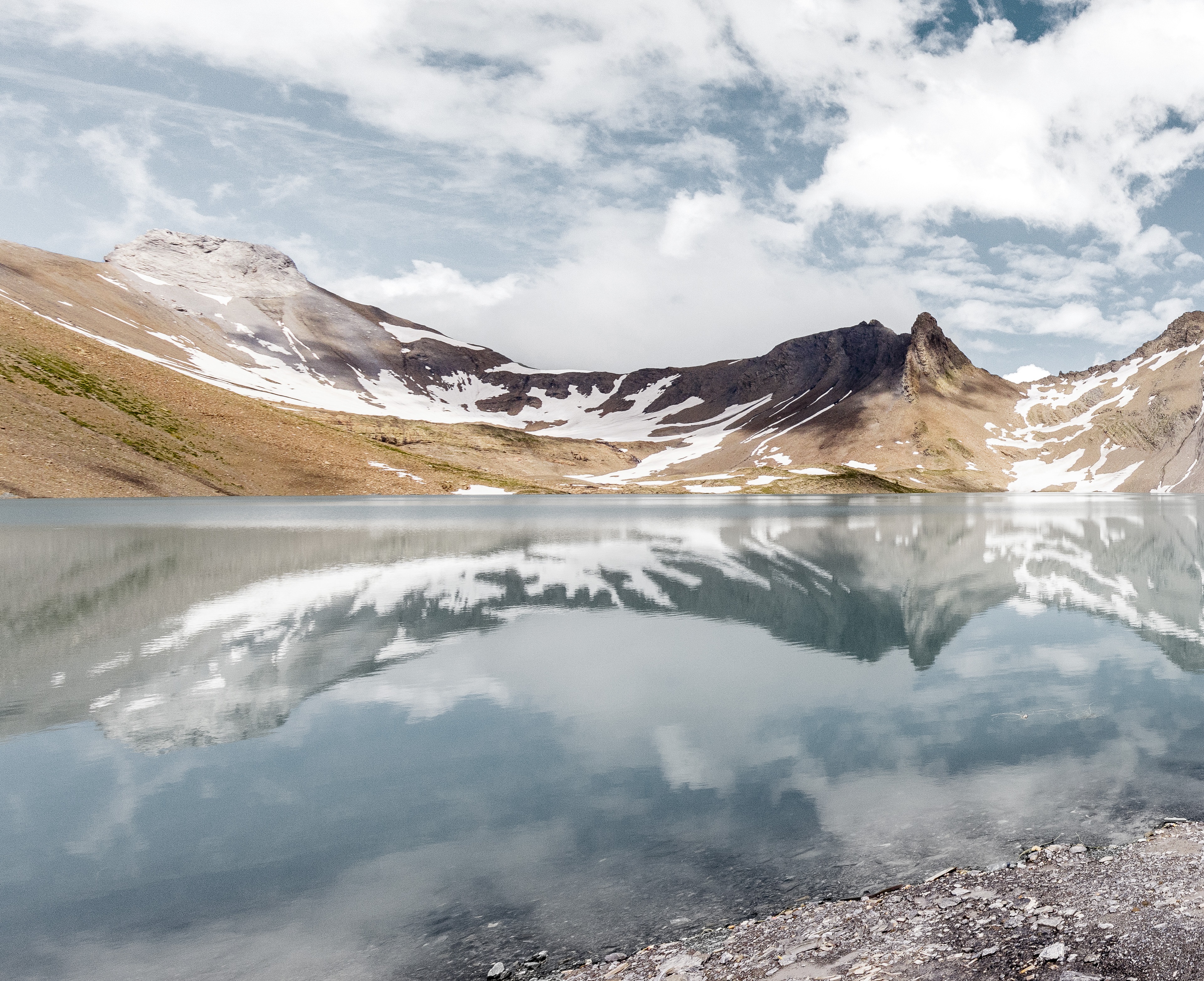
21.01.2021 | Enjoy the mountains and the cool alpine air at the Muttsee
Off to the mountains!
The Muttsee is not only part of Axpo's Limmern pumped storage plant it is also part of the highest alpine solar plant in Siwtzerland and a hikers' paradise as well. The Muttsee Hut located in an idyllic setting at 2501 metres a.s.l. can accommodate 69 people and is the perfect place to spend the night. A great way to cool off away from the summer heat in the Midlands.
Whew, made it. Take of the backpack and wipe off the sweat. One doesn't want to "look exhausted" although the 600-metre ascent does get one huffing and puffing. The panoramic view of the Nüschenstock, Ruchi, Muttstock, Selbsanft and other Glarus peaks is a well-deserved reward for the effort.
We are at 2500 metres above sea level. This is the location of the highest dam in Europe, and the longest in Switzerland with a length of 1054 metres: The dam and the Muttsee Reservoir are part of Axpo's new Limmern pumped storage plant with a 1000 MW pump and turbine capacity. In summer 2021 Switzerland’s largest alpine solar plant will be built. A real pioneering achievement in partnership between Axpo, IWB and Denner.
With the pump storage plant Limmern, Axpo has a giant battery at its disposal in the Glarus Alps. This film explains how a pumped storage plant works:

Off to the tunnel
In the summer months the reservoir and the hut on the Muttenalp are accessible by means of a special route. From Linthal-Tierfehd take the Linth-Limmern power plant aerial cable-wayup to the mountain station. From there, a trail approx. 3 kilometres long leads through the power plant tunnel over to the Limmern Reservoir.
Boing, boing, boing: Hikers' steps echo in the corridor of the cool tunnel illuminated with neon tubes. The mysterious, flamboyant yellow markings on the rock walls create a sense of adventure: The scene could be right out of "Indiana Jones".
After about three kilometres a small, grey door opens and one is greeted by the sunlight and the turquoise-coloured lake Limmern. From here, a partially restored, fairly wide trail that becomes narrower further on leads steeply up to the Muttsee Hut and the lake of the same name. The trail passes two rock outcrops have been secured with chains and then continues on past blooming meadows. With a bit of luck, the "early birds" can get a glimpse of mountain goats, chamois, snow grouse, eagles, marmots or foxes. Here are the photos - truly worth seeing!
Oasis at 2500 metres above sea level
Alternatively, one can take the colourful trail from the mountain station over Chalchtrittli, Nüschen and Muttenwändli to get to the hut. This trail has guard chains at exposed locations, but is only recommended for hikers who are not afraid of heights.
The Muttsee Hut, an "oasis at 2501 metres a.s.l.", has 69 bunks. Hut warden Claudia and her team look after the guests. Aside from being the hosts they handle cooking, baking, waiting tables, housekeeping and repairs. And they do their job with heart and soul.
Axpo 4 lakes hike
What is the end destination for some is merely a stopover for others en route via the Kisten Pass Hut to Surselva and down to Brigels (approx. 7.5 hours, 20.2 km, ascent 1078 metres, descent 1670 metres).
A narrow trail leads up the "Chistli" Hut. It looks rather like an eagle's nest resting on the rocks. The view over the Selbsanft, Bifertenstock and Tödi is impressive, and the look down to the lake Limmern is breath-taking.
From there the highest point of the hike at 2729 metres a.s.l. is quickly reached over a metal stairway. Then the trail goes in only one direction – down – first toward the Kisten Pass, and then more to the left passing the Biferten Hut and ending in the village of Brigels.
The second day of this Axpo 4 lake tour is somewhat less challenging. Passing the Lag da Breil Reservoir (belonging to Kraftwerk Frisal AG and Axpo Hydro Surselva) the trails takes hikers to Waltensburg and Andiast. From there the trail goes up to 1452 metres a.s.l. to the Lag da Pigniu (Panixersee/Kraftwerke Illanz AG) leading around the lake with its beautiful water falls and back down to Pigniu (approx. 4.5 hours, 17.3 km, ascent 568 metres, descent 538 metres).
For experienced hikers there is a two-day tour with an overnight stay in the Biferten Hut and a second hike over a pass on the following day. The Panixer Pass is the pass that the Russian General Suwarow took while crossing the Alps in 1799 with his 25,000-man army on the way back to Russia (more information here). The route down to Elm takes about 7 - 8 hours.
And by the way: This is how the Limmern PSP was built:

And if you are too lazy to hike, you can simply fly over the landscape here.


